Lewis Loops 10M
Our event will be back in 2022, and as soon as we have an approved permit we will announce dates and registration links.
What began as a simple discussion about "no short distance trail races in the Rogue Valley" years ago (and created the Bandersnatch 5K) has evolved into a race that puts the pain in a 10 mile course. After the Bandersnatch 5K was created, our community came together (through the work of AWTA) to continue to add to our trail system, and with the addition of the Lewis Loops an idea was born for a "mid distance" tour of our trail system, the Lewis Loops 10M course. Far from an easy 10M, there are plenty of climbs, some beautiful trails and views, and a lot of fun. Join us for an amazing tour of some of our newer trails of the Ashland watershed.
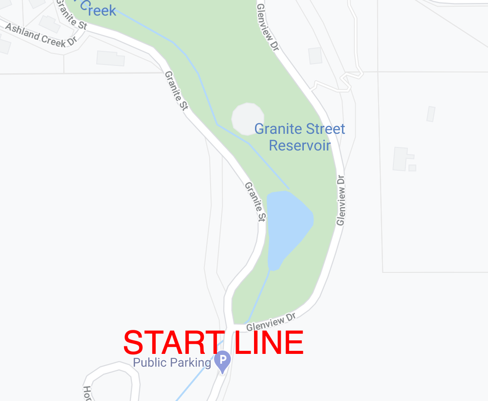
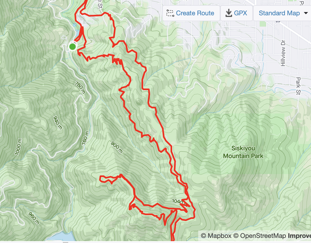
The course begins and ends at the end of Ashland's famous Lithia Park, where the reservoir area meets the road (Granite Street becomes Glenview Drive (see map below). The course runs up Glenview, making a sharp right up Ashland Loop Road - the same route the HillClimb takes. From there you will make a right turn and head up Lower Red Queen Trail, to Jub Jub, which will take you down to part of lower Bandersnatch and back to the Loop Road. From there you will simply climb the road to the top of portion of Caterpillar trail (it will be a near U-turn); it will be well marked. From there you will head down Caterpillar and make a left onto the Lewis Loops trails. You will complete both loops (clockwise) back to Caterpillar and down to the top of Red Queen. From there Red Queen will be your home until you hit Gryphon trail, for one last fun little climb up to Bandersnatch. You will run down Bandersnatch back to the start/finish area, thus completing the 10 mile route.
Beginning in 2019, the event shirts were officially designed by our RD's daughter (2 years old at the time) and will continue to be done so that each year is unique, and so that our RD can see his daughter's work proudly displayed all around town. The shirts were a smash hit the first year, so make sure you register early to insure you reserve yours!
Registration link is here.
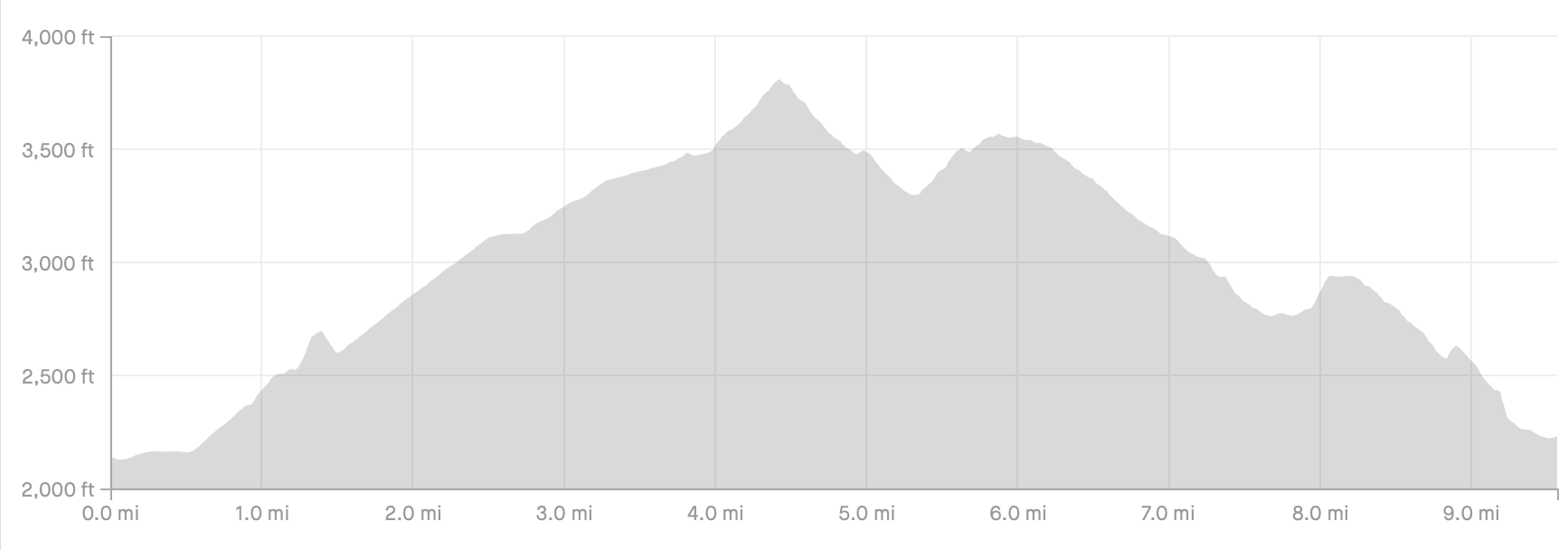
Below is the elevation profile of the route and a GPS map of the course. As you can see, simple, straight forward and barely any climbing at all.


